Kintyre 66

Scotland's Adventure Coast

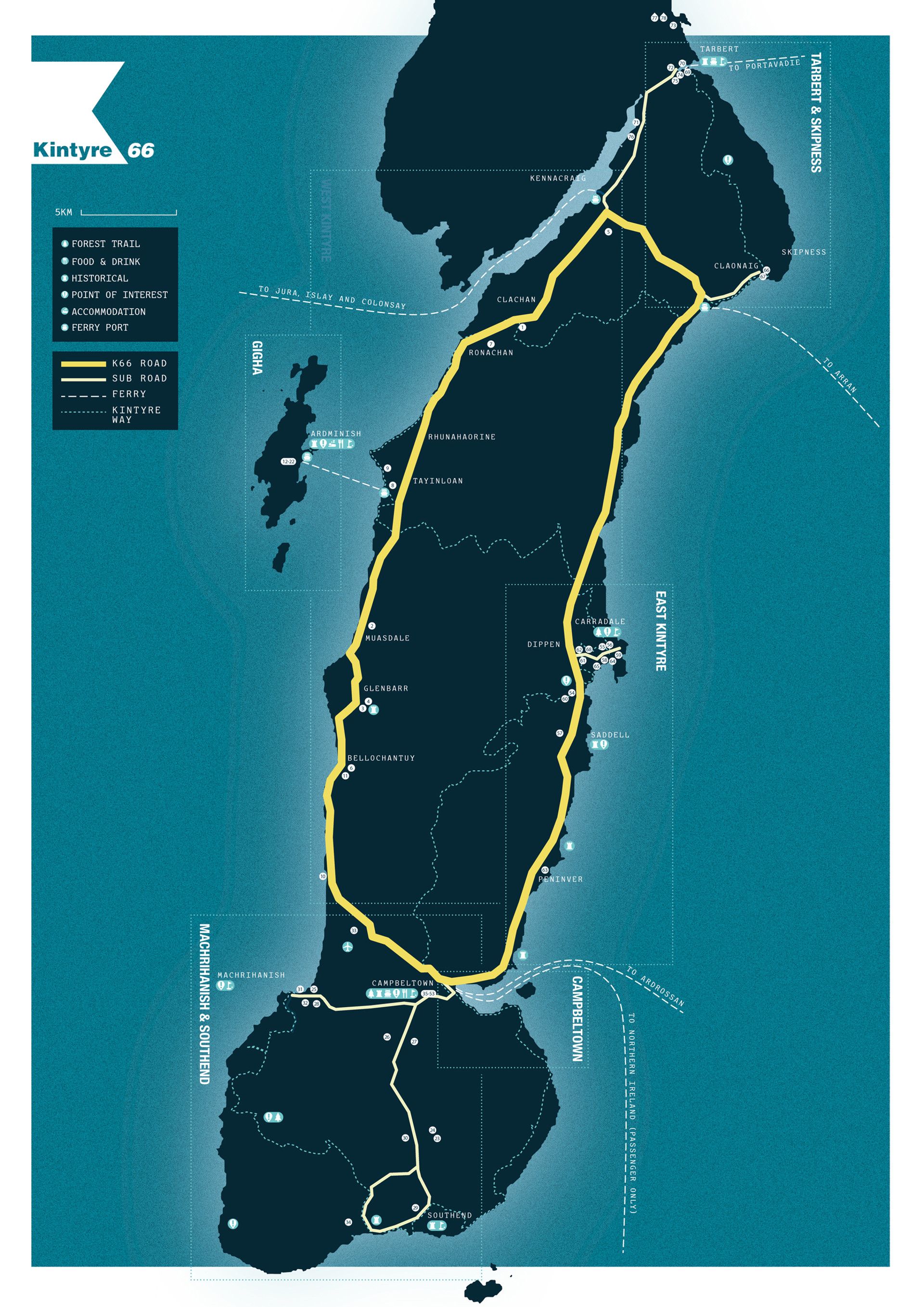
The Kintyre 66 (K66) is an exciting 66-mile loop route around Kintyre that will help you discover one of Scotland’s most scenic regions – and what so inspired Sir Paul McCartney all those years ago.

With its pristine natural setting, unique coastal character and rich history, you will never run out of things to do in Kintyre and Gigha: Dine on the freshest seafood and savour some of the world’s most famous Scotch whiskies. Be spellbound by the region’s magnificent wildlife. Kayak in turquoise waters and walk in the wilderness. Marvel at early standing stones and visit castles of the famous clans.

Whatever your preferred way to travel along the Kintyre 66, one thing is guaranteed: You will never tire of Kintyre!


Kintyre 01
Background image - Waa Background
Download the Kintyre 66 Brochure & Map

Plan your adventure to Kintyre with out detailed Kintyre 66 brochure, including places to stop, recommendations and distances.

Download Brochure
Background image - K66 Lighthouse Copy (1)
Background image - Kintyre 66 Map

Kintyre 66 Route Overview

Planning Your Journey

The Kintyre 66 follows a 66-mile loop around Kintyre on the A83 and B842 public roads, with 6 spurs allowing you to venture even further. Take the Atlantic road south with stunning views to Islay and Jura, and then up the edge of the Kilbrannan Sound overlooking Arran, or why not travel in the other direction, taking time to enjoy all the area has to offer – the choice is yours!

Leave the car behind!

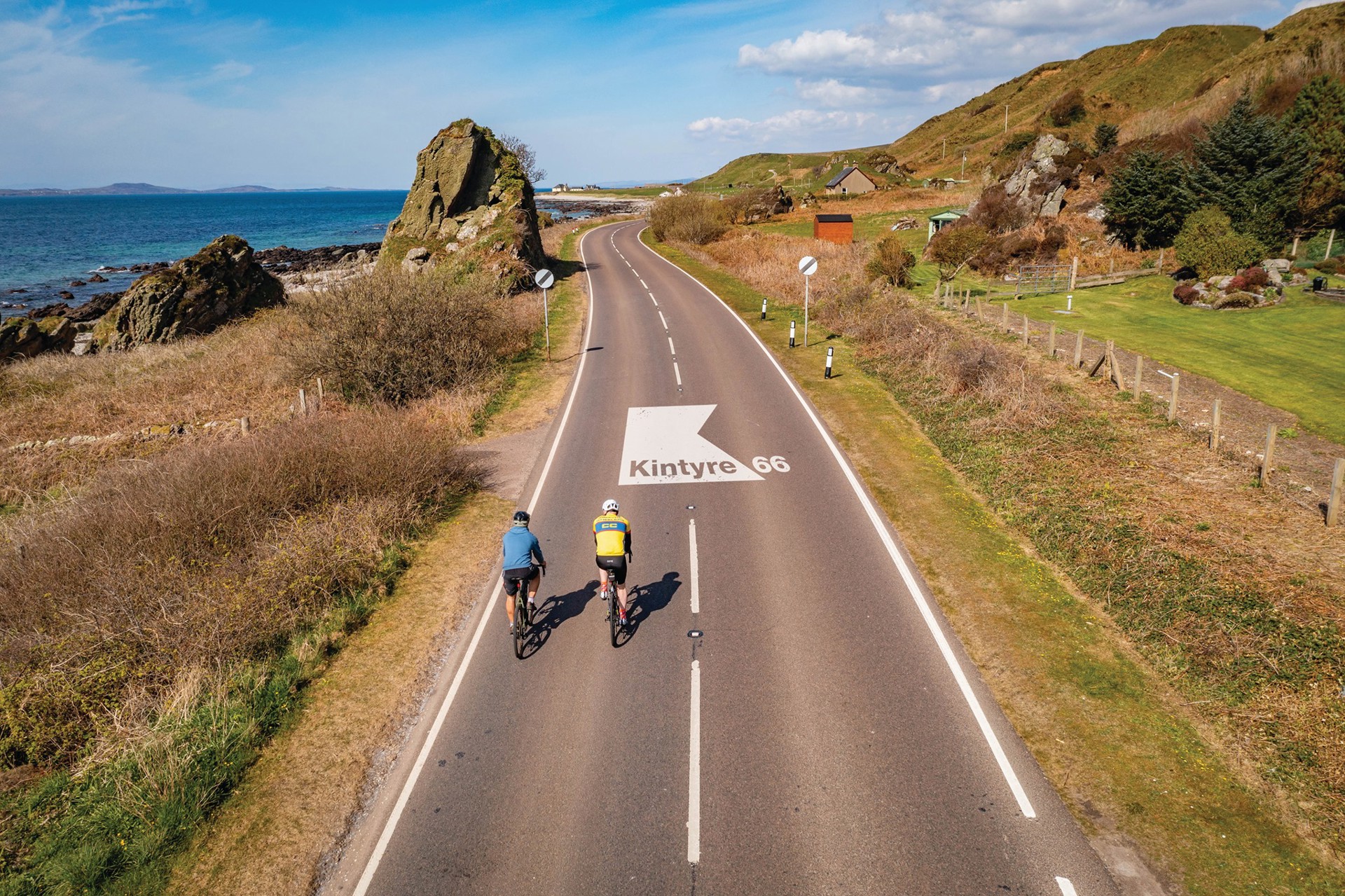
This route can be completed as a road trip, cycling adventure or even partly on foot. For cyclists, we recommend following the Caledonian Way, or Route 78, which runs from Inverness to Campbeltown. Or why not ‘ferry hop’ with your bike and explore Kintyre and beyond? Once here, there are plenty of biking options for short excursions or longer cycles.

Alternatively, you could walk the Kintyre Way, a 100-mile long-distance route, which starts in Tarbert and finishes in Machrihanish, traversing the peninsula several times. This is a spectacular way to enjoy the area and all it has to offer at a slower pace.

Download our detailed brochure for more information about each section of the Kintyre 66 and the matching route map to help you plan your trip.

K66 Route Map

The Kintyre 66 itinerary

Where to stop along the Kintyre 66?

The Kintyre 66 takes you to the 6 main areas along the Kintyre peninsula. Below we have information on Southend & Machrihanish, Campbeltown, East Kintyre, West Kintyre, Gigha and Tarbert.

Tarbert & Skipness

Tarbert 

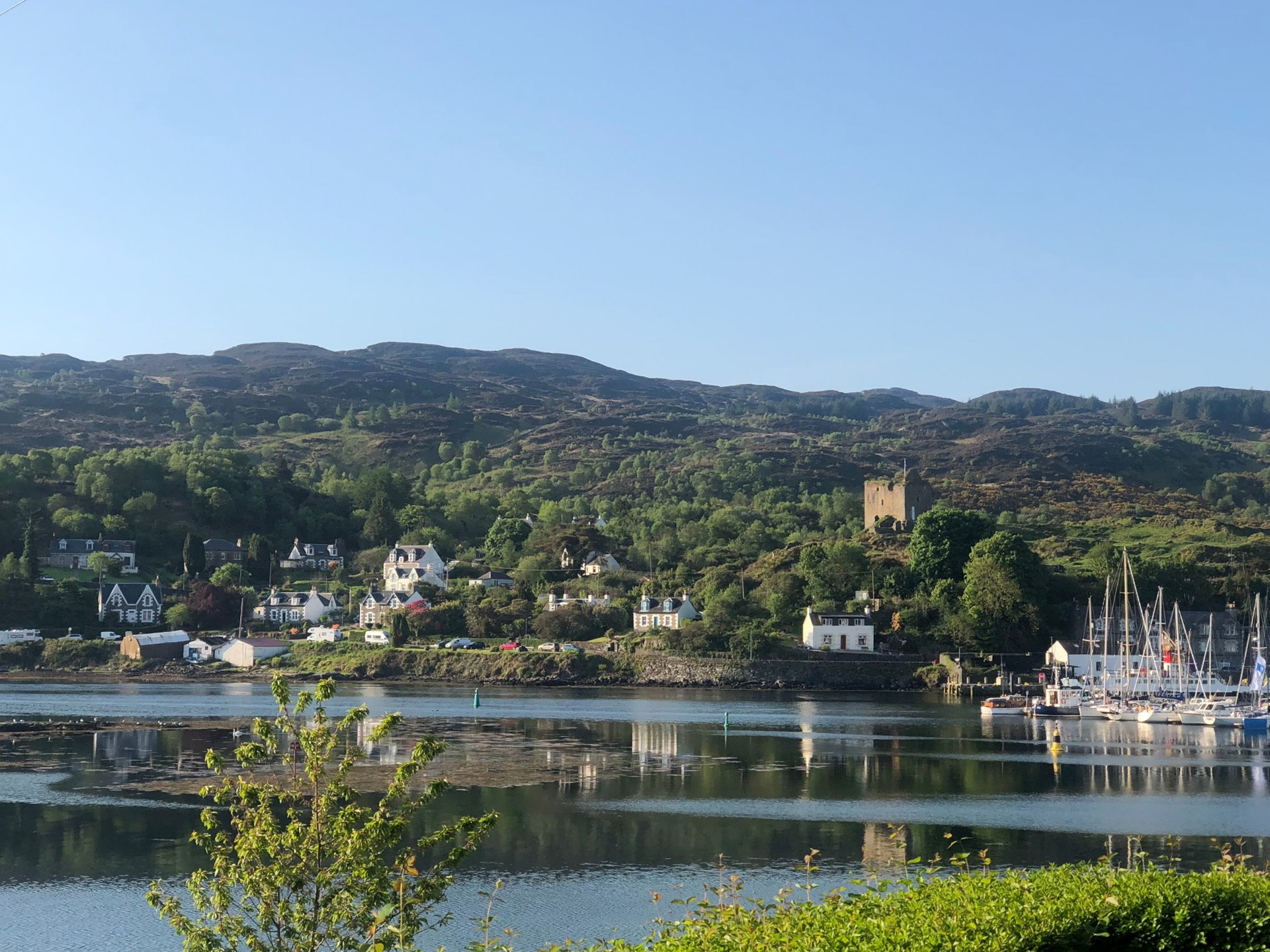
Start your journey in Tarbert, the gateway to Kintyre. It’s a working fishing village and the shops, hotels and art galleries cluster around the natural harbour. Before you head off on your journey, take the short walk up to Tarbert Castle. 

Skipness

From Tarbert, head southwest on a winding single-track road through beautiful countryside to Claonaig and the village of Skipness. It’s well worth taking the time to visit Skipness Castle, where you’ll be treated to incredible views across the Kilbrannan Sound to Arran. In the summer, feast on fresh seafood from the Skipness Seafood Cabin in the castle grounds and check out the Skipness Smokery. Pop by Skipness Village Shop to stock up on road trip snacks!

Visitscotland Skipness Castle

East Kintyre

Follow the road along the rugged east coast of Kintyre and enjoy spectacular views to Arran, Ailsa Craig and the Ayrshire coast beyond!

Carradale

Take the short detour to Carradale, where there’s a magnificent sandy bay and a golf course. Carradale is a brilliant spot to stop for the night with plenty of accommodations, shops and eateries. 

Saddle Bay

Saddle Abbey is a ruined Cistercian monastery, and a fascinating place to explore. The highlight is a collection of late medieval grave slabs, displayed in a shelter. From Saddell, you can walk to Saddell Bay, passing Saddell Castle. This wild and remote beach was used in the video for Mull of Kintyre, the multi-million-selling song by Paul McCartney and Wings. Look out for the sculpture standing on the rocks in front of the castle.

Image: 'Grip' by Antony Gormley, Saddle Bay © Raymond Hosie


saddell_castle_please_credit_raymond_hoise.jpg

Campbeltown

Continue along the B842. Before you reach Campbeltown, you’ll see Davaar Island. This tidal island is linked to the mainland by a natural shingle causeway. You can walk across the Dhorlin at low tide in around 40 minutes, but check the times of the tides, or you could get stranded!

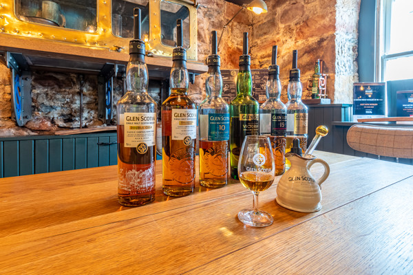
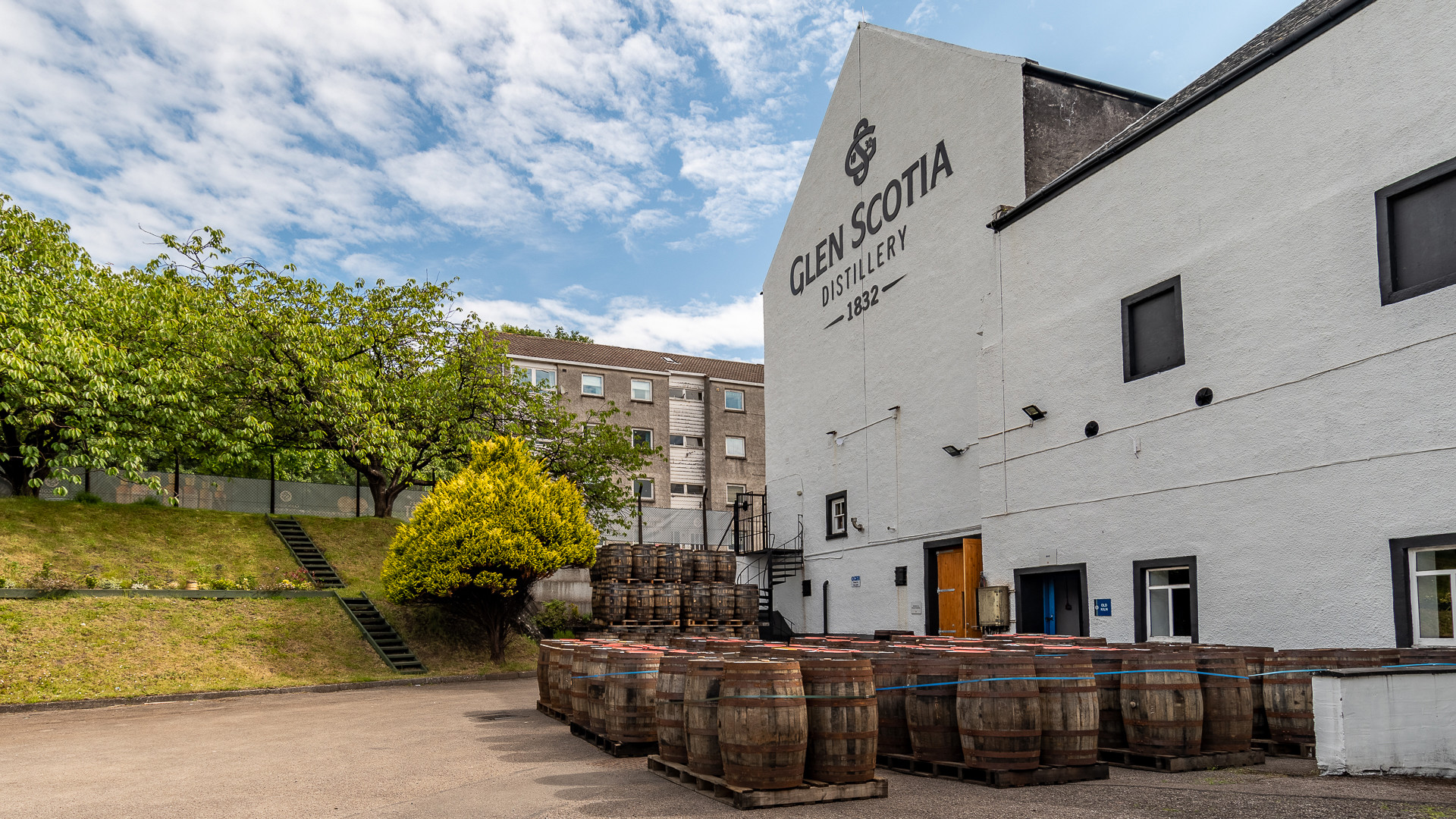
Your next stop is Campbeltown, historically known as 'the whisky capital of the world'. This bustling town is home to no less than three whisky distilleries, as well as lots of shops and cafés. If you have time, it’s well worth taking a distillery tour at Glen Scotia to discover Campbeltown’s fascinating whisky heritage.

During the summer, Campbeltown also hosts a range of music festivals and events, which make your visit extra special. No matter the season, make sure to drop by the Victorian Campbeltown Picture House, Scotland’s oldest
purpose-built cinema!

scotland_argyll_and_bute_campbeltown__glen_scotia_distillery_barrels__004.jpg

The Mull of Kintyre

Machrihanish & Southend

From Saint Columba’s footstep and clan massacres in the south to
a Championship golf course and surfer’s paradise in the west, this area includes the two small villages of Southend and Machrihanish.

Mull of Kintyre

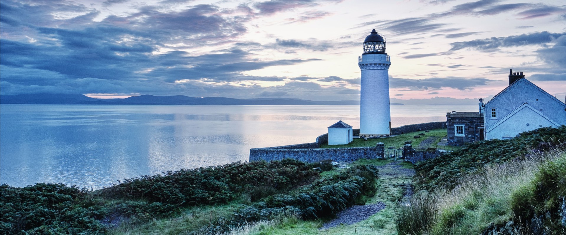
At the extreme southwestern tip of the Kintyre peninsula sits the Mull of Kintyre. It’s a wild and remote place, made famous by the 1970s Paul McCartney and Wings’ hit. If you want to understand why McCartney was so inspired by the place, then you need to follow the long and winding road that takes you there. It’s slow going but the journey is worth it for the views alone - even if the mist isn’t rolling in!

mull_of_kintyre_lighthouse_-.jpg

Kintyre's West Coast

Enjoy the Atlantic coast of Kintyre, with thundering waves and
unmissable sunsets over the islands of Gigha, Cara, Jura and Islay,
not to mention glimpses of Ireland to the south. 

Westport Beach

Stop for a stroll along the famous Westport Beach to soak in the spectacular coastal views. This beach is also brilliant for watersports, such as surfing and windsurfing. Depending on the season, you will find local surf schools providing lessons and equipment hire.

Historic Sites

You will find many historic sites along the West Coast of Kintyre, such as the ancient Killean Church and Graveyard and the medieval grave slabs at Clachan Church. The Ballochroy Standing Stones stand as a dramatic prehistoric marker aligned with the mountain peaks of Jura, while Dun Skeig’s hillfort provides a glimpse into early defensive settlements dating back as far as the Iron Age. The Kintyre Way links these sites, so why not walk a leg of this long-distance trail?


westport_beach_credit_raymond_hosie.jpg

Isle of Gigha

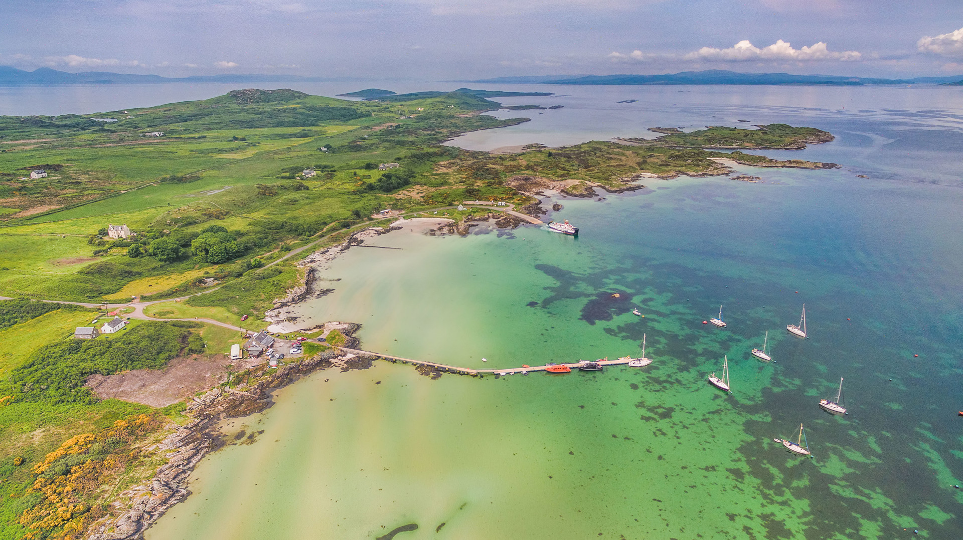
From Tayinloan on Kintyre's West Coast, you can catch the 20-mins ferry to the Isle of Gigha, a small yet utterly captivating island.

Gigha: A Place of Discovery

The community-owned island of Gigha is a truly breathtaking island with white-sand beaches, crystal clear seas, stunning views, amazing sunsets, and a huge variety of wildlife.

We recommend spending the night, allowing you to truly immerse yourself in the unique island spirit of Gigha. Rent a bike at the island's activity centre to explore the island, wander through the vibrant Achamore Gardens and spend your evening marvelling at the night sky.

Discover More
Isle Of Gigha Heritage Trust
K66

Good to know!

Common questions about the Kintyre 66
How do I access the route?

The Kintyre 66 can be accessed via road, air or the water, which is a pretty special way to arrive.

The main way to travel to and from Kintyre is by car or by bus via the A82 and then the A83 – with a short ferry trip to Gigha from Tayinloan on the Kintyre peninsula. From the north of Scotland, come via Oban on the A816 to pick up the A83.

Or if you are travelling from Southern Scotland, why not sail from Ayrshire to Campbeltown using the CalMac ferry link*? This connects with the Glasgow train service. Or cross by ferry via Arran or Cowal to Kintyre – allowing you to explore much more of the west coast. Don’t forget you can bring your bike on the ferry and you can link as part of the National Cycle Route 78.

Regular flights take off from Glasgow to Campbeltown with Loganair, throughout the year.

*Please check all ferry routes are running as they can change per season.

Do I need to do the route in one day? How long will it take?

No, you do not need to do the route in one day, in fact we encourage you not to for the sake of your own enjoyment and experience. If done in one continuous loop, it’s only 66 miles, but the joy of Kintyre is that there’s many trails, coastlines, walks, places to visit and of course stay. You can take as much time as you like, to spend some memorable time here and explore all 6 regions of West Kintyre, Gigha, Machrihanish & Southend, Campbeltown, East Kintyre and Tarbert & Skipness.

Can I drive the route in any direction?

Of course. Go in any direction you please and try at different times of the day. You’ll see spectacular sunrises from the east side of the peninsula, and mesmerising sunsets from the west side. There’s no one way system, but some of the route is a single-track road, so enjoy taking it easy and make use of the passing places by giving a wee wave to passing traffic.

What are the top must-see things not to be missed?
Background image - Waa Single Letter Outline

There are so many and different things will interest different people but here’s some of our favourites off the beaten track.

  • Ballochroy Standing Stones
  • Saddell Bay, Castle and Abbey
  • Skipness Castle and Woodland Walks
  • Southend Beach and Dunaverty Rock
  • St Columba’s Footprints and Keil Caves
  • Westport Beach, Machrihanish
Campbeltown & Kintyre
Background image - Gormley Saddell Bay
Can I only do the route in my car?

The road is accessible by car for the whole loop, but it can equally be enjoyed as a cycle route and on e-bikes too. Cycling is the ideal way to stop off at any point and go explore the many side roads or go inland and join The Kintyre Way.

What facilities is there for food and fuel?

Our detailed map which will be launched soon will include all the places you can refuel yourself, as well as your car, and of course charge your e-bikes if needed! There’re places for little people to pick up tasty treats and adults to top up their energy levels with hearty meals, including distilleries to help quench any thirsts.

Download the map
Are there public toilets along the route?

Yes, there are.

Are there electrical car / e-bike charge points?

Yes, we really do welcome hybrid and electric vehicles. You can find charging stations on our map.

Can I stay over?

Oh, we’d love you to stay over, for as long as you like, actually! There’s a great choice of self-catering, hotels and B&Bs throughout the year and for all budgets. All will be detailed on our map or on our website here.

I’ve never visited the west coast of Scotland, what is the climate?

Well that can range from -5˚to 30˚ on a record-breaking day! The climate changes throughout the year, but as Kintyre is on the Gulf Stream it enjoys a milder temperature than the highlands for example.

What type of clothing to do I need?

Whatever you feel comfortable in. Literally. Get your trainers and hiking boots on for some exploring, or barefoot and beachwear for water sports, or bring your glad rags for a great night out wining and dining. There are no rules but it’s always wise to have layers, waterproofs and sunscreen.

Will it be busy? What is the best time of year to visit?

Kintyre is never overly busy as it’s a hidden gem on the west coast with lots of unspoiled places to discover. There’s plenty of places, open spaces, coastlines and places of interest to spread out and maybe never see anyone else on some days. Tarbert and Campbeltown have more buzz as they are the main towns, with the busiest season being between April-October.

Is it just one road?

There is one main road (A83 on the west side and B842 on the east), but the Kintyre 66 is much more than that! With various spurs off the main road you can explore the south of the peninsula out to Machrihanish and down to Southend and up to the north to Skipness. There's plenty of smaller roads branching off in various directions, and of course, the route includes a ferry trip across the water to the beautifully small island of Gigha - which can be easily enjoyed on foot or by cycling.

Will I be near water?
Background image - Waa Single Letter Outline

Yes, you’ll enjoy views of the water from pretty much everywhere here. Perfect to watch and calm your mind, or get active with some watersports including surfing, wild swimming, kayaking, sailing and much more. Boat trips to the surrounding islands and the mainland run frequently too.

Explore
Background image - Kintyre 66 Robin Mckelvie Robin Exploring The K66
Are there lay-bys / parking?

Yes, these are well signposted for all road users. Just a gentle reminder that ‘passing places’ are only for letting passing traffic by, not for parking. Please use dedicated parking places.

Can I come in my campervan / caravan?

Yes, you can but towing is not well suited on single track roads. There are dedicated motorhome spaces at Muasdale and at West Loch Shores. We ask that you be respectful of other road users and the local communities when choosing places to stop or park - if in doubt, ask a local where is best to stopover.

Are there dedicated picnic spots?

There’s plenty and clearly signposted. If you decide to enjoy some al fresco dining on the beach or any other spot, we kindly remind you take away all your rubbish and put in a dedicated bin or recycling point. Our landscape and wildlife are precious so we encourage you to leave no traces behind.

Are there any animals roaming free I should look out for?

We have a great mix of wildlife for you to spot in its natural habitat. From free roaming deer, otters, seals, birds, pheasants, sheep and so much more. Sometimes they can wander on to the roads so just always take your time to take care of them. And don’t forget to take care on farmland too where livestock are, including cows, sheep and horses.

Are there road signs to clearly navigate my route?

Yes, our lovely peninsula is easy to navigate so feel free to turn off the Sat Nav if you please and just relax on your trip. You won’t see ‘Kintyre 66’ branded signs but you’ll easily spot all the places from our map by name and road name.

Background image - Waa Background
Download the Kintyre 66 Brochure

Plan your adventure to Kintyre with out detailed Kintyre 66 brochure, including places to stop, recommendations and distances.

Download Brochure
Background image - Kintyre 66 Cycle

Explore more of Argyll & the Isles

Stay Icon
STAY
Explore
See Do Icon
SEE & DO
Explore
Food Drink Icon
EAT & DRINK
Explore
WHATS ON 01
WHAT'S ON
Explore